by Bob Shively, Enerdynamics President and Lead Facilitator
Ever read about a gas leak and wondered if there is a gas storage field near you? Or where the closest power plant is? Or maybe you heard about a major storm on the news and wondered what energy facilities lay in its path? There’s a great free tool on the Energy Information Administration website that allows you to quickly and easily answer such questions.
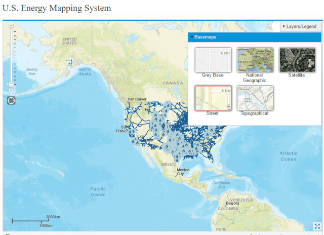
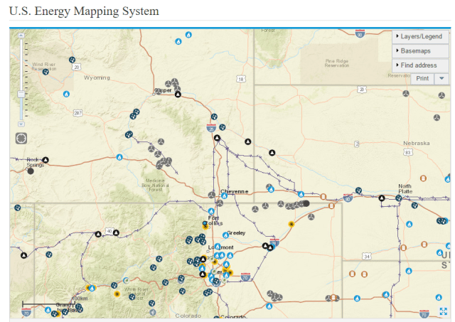
To access this tool, go to http://www.eia.gov/state/maps.cfm. You will see something that looks like this:
Let’s say I wanted to see what energy facilities are located near Enerdynamics’ offices in Laporte, Colorado. I can use the interactive menu in the upper right and corner and start exploring what facilities are nearby.
First let’s take a look at natural gas facilities. I know there are lots of gas pipeline and processing facilities in our region, but I want to see specifically where they are located. Finding out is simple.
I use the menu to select only the gas facilities I am interested in. To do so, I open the Layers/Legend section, and click the red X that says Remove All to clear the menu. Then I click the boxes next to Natural Gas Processing Plant, Natural Gas Inter/Intrastate Pipeline, and Natural Gas Underground Storage. Now the map shows all processing plants, all high-pressure pipelines, and all underground storage facilities.
Also, I want to see this down to the street level, so I use the Basemaps menu section to select Street.
Then I enter our address into the Find Address menu, and here I see a map that makes me think there is nothing in my area:
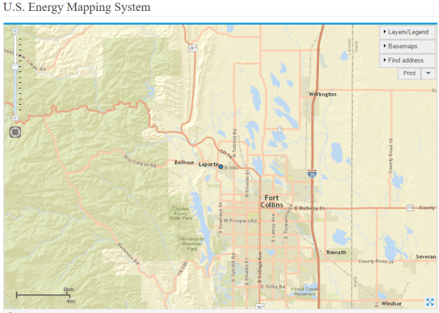
But this isn’t true, because the mapping system only shows certain facilities if the map is above the scale of 1:1,000,000. So I zoom out a little and find that while there are not facilities right in Laporte, there are numerous gas pipelines to the north and east, gas processing facilities around Greeley, and underground storage in the area of Fort Morgan.

An important SAFETY WARNING: This map only shows high-pressure pipelines and is not showing distribution facilities. So don’t think you can go digging in Laporte without worrying about hitting a gas line!
Now suppose I wanted to find out more about the closest processing plant north of Greeley. I simply click on the icon on the map and see detailed plant information:

Similarly, if I am interested in electric facilities, I can see all the power plants and transmission lines above 345 kV:
And I can get plant-specific information:

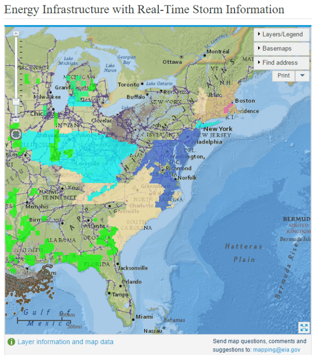
Although we won’t discuss it in detail here, a similar tool located at http://www.eia.gov/special/disruptions/ allows you to see what facilities are in the path of coming weather events: